News

Weather
Posted: May 15, 2024 9:57 AMUpdated: May 16, 2024 5:27 AM
Area Increased to 'Enhanced Risk' of Severe Weather Wednesday Night

The severe weather risk for portions of our listening area has increased again for Wednesday.
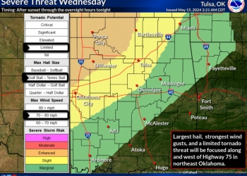
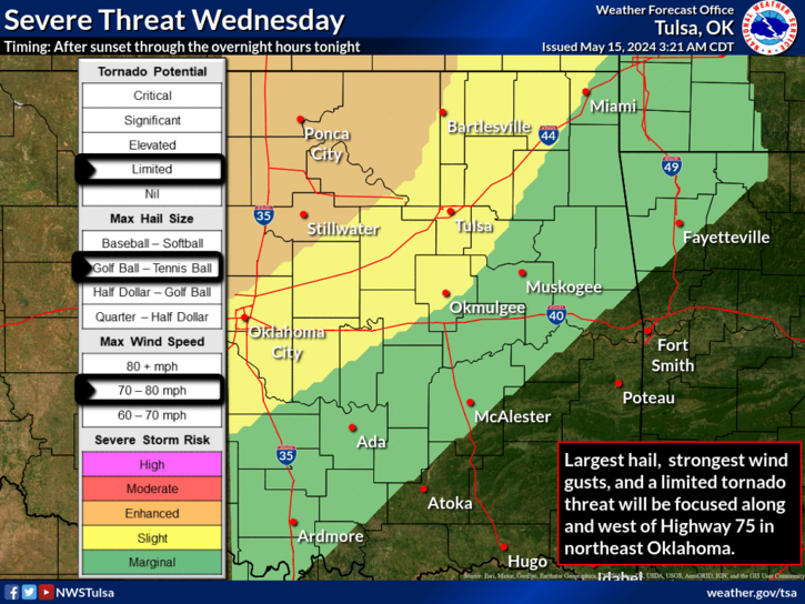
According to the National Weather Service, strong to severe storms will move into northeast Oklahoma and southeast Kansas Wednesday evening and continue into the overnight hours. Focus of the strongest storms will be along and west of Highway 75 in northeast Oklahoma.
The weather service says the main hazards will be large hail and damaging wind gusts. However, a low tornado threat also exists, mostly for portions of Osage and Washington counties in Oklahoma and Chautauqua County in Kansas. The risk in those areas have increased to an enhanced level (Level 3 of 5).
Moderate to heavy rainfall will also occur with the strongest thunderstorms. Multiple rounds of rain are expected through the rest of the workweek. The heaviest rain will occur in 2 rounds: Wednesday night into Thursday morning and again Thursday night into Friday morning as two upper level storm systems swing across the Plains.
The National Weather Service says 3-4 inches of rain are possible in the Bartlesville area.
.png)
« Back to News